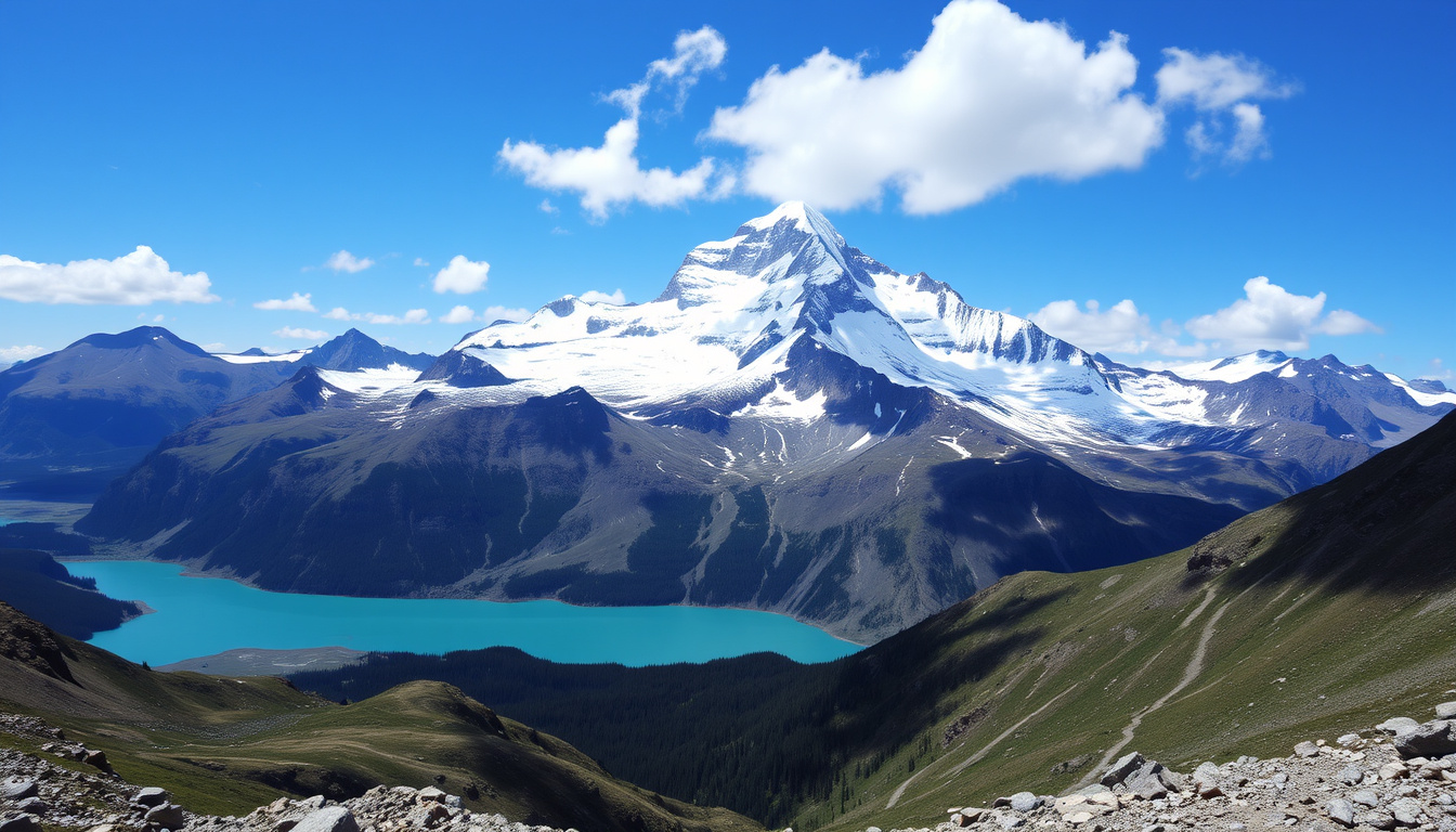
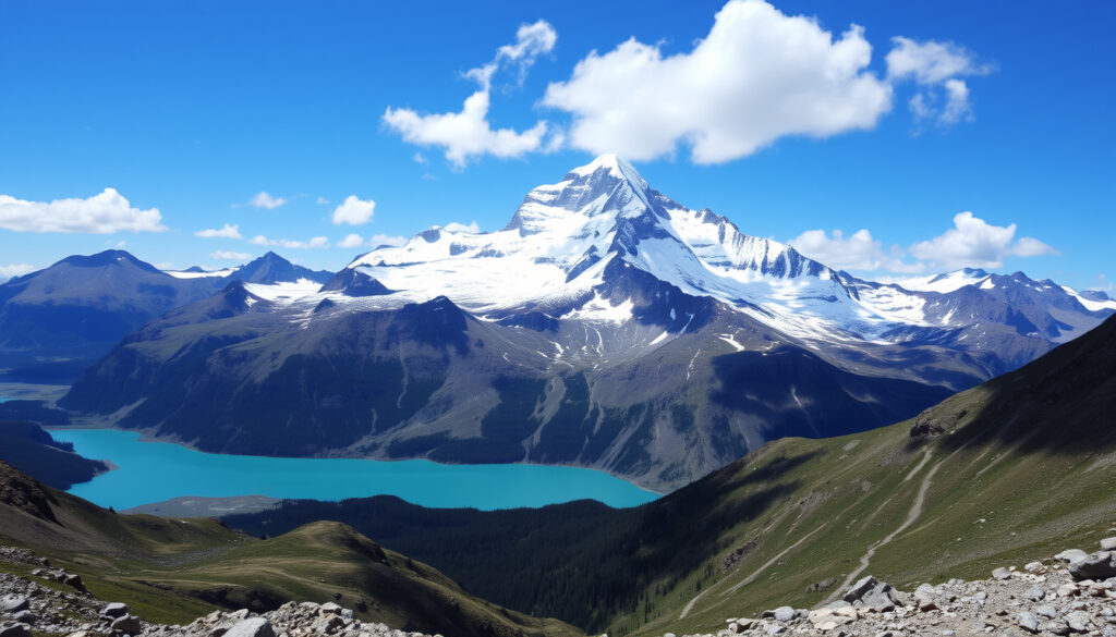
Mount Robson has a way of staying hidden. Most days, the highest peak in the Canadian Rockies wraps itself in cloud, visible only about a dozen times a year. For climbers who make the journey, that unpredictability is part of the challenge — and part of the draw. This guide breaks down what it really takes to climb it, how long you need, and when the mountain actually shows itself.
Height: 3,954 m (12,972 ft) ·
Location: British Columbia, Canada ·
First ascent: 1913 ·
Prominence: 2,829 m (9,281 ft) ·
Average visibility: 12 days per year ·
Difficulty (Fuhrer Ridge): IV 5.4
Quick snapshot
- Highest peak in the Canadian Rockies – 3,954 m (Wikipedia)
- Standard route Fuhrer Ridge rated IV 5.4 (Yamnuska Mountain Adventures)
- Guided ascents typically take 5–7 days (Global Summit Guide)
- Exact guided vs. unguided success rate (varies by season and conditions)
- Whether recent weather patterns have shifted average visibility
- Guided trips: 4–6 days average, can stretch to 10 days with weather (Global Summit Guide)
- Best climbing window: mid-July to third week of August (Yamnuska Mountain Adventures)
- Book a guided expedition if you’re new to grade IV climbs
- Check the Mount Robson Provincial Park website for seasonal permits
Six key specs, one standout: the mountain rises nearly 3,000 m from the valley floor, a vertical gain matched by few peaks in North America.
| Specification | Value |
|---|---|
| Height | 3,954 m |
| Prominence | 2,829 m |
| First ascent | 1913 by W.W. Foster, A.H. McCarthy, and party |
| Standard route | Fuhrer Ridge (IV 5.4) |
| Park boundaries | Mount Robson Provincial Park, BC |
| Average summit days per year | 12 |
How hard is it to climb Mount Robson?
Mount Robson is a serious mountaineering objective. Every route on the mountain is rated at least Alpine Grade IV, and there are no non-technical paths to the summit (Global Summit Guide mountaineering route database). The standard Fuhrer Ridge route is rated IV 5.4, meaning sustained steep rock and ice requiring technical skills and a high level of fitness.
Technical difficulty of the Fuhrer Ridge route (IV 5.4)
- Grade IV implies a full day of technical climbing with multiple pitches of 5.4 rock and steep snow/ice.
- Exposure is extreme: the upper ridge narrows with significant drops on both sides.
- Most parties use fixed ropes on the steeper sections.
Required experience and fitness
Climbers should be comfortable with cramponing on 50–60 degree slopes, self-arrest, and crevasse rescue. “It’s a step up from even the other big Rockies peaks,” says a guide from Yamnuska Mountain Adventures (Rockies guiding specialists). “The combination of route-finding, weather, and altitude makes it a real test.”
Guided climb options and success rates
Most ascents are guided. The overall summit success rate is reported at roughly 10% (Global Summit Guide), though guided parties may fare better with flexible schedules. Solo ascents are extremely rare.
How long does it take to climb Mount Robson?
Most guided expeditions carve out five to seven days, but the actual time on the mountain can vary wildly depending on conditions.
Standard guided itinerary (typically 5–7 days)
- Day 1: Approach to the hut (Ralph Forster Hut, about 1,700 m ascent from the trailhead) (Fastest Known Time).
- Day 2: Acclimatization and skills review.
- Day 3: Summit attempt (often 12–18 hours round trip from high camp).
- Days 4–5: Descent and buffer for weather.
A 4-day climbing structure is possible in favorable conditions, as outlined by Ian Welsted Climbing and Adventure Guiding (Canadian Rockies guide): Day 1 approach, Day 3 summit push, Day 4 descent.
Factors that can extend the climb
Weather is the biggest variable. Trips can stretch to 6–10 days when a viable summit window is delayed (Global Summit Guide (Rockies routes)). Deep snow or unstable conditions add rest days.
A 5-day trip might give you only one summit window. A 10-day trip triples the odds but demands more vacation time and budget. For most guided climbers, the sweet spot is 6 days.
The implication: plan for a week, be ready to leave early, and don’t book a flight home the day after the planned summit.
Is Mount Robson the tallest peak in Canada?
No — but it’s the tallest in the Canadian Rockies. The distinction matters because many people assume “highest in the Rockies” means “highest in Canada.”
Mount Robson’s rank within Canada
Mount Robson (3,954 m) is the highest peak in the Canadian Rockies, but Canada’s tallest mountain is Mount Logan (5,959 m) in the St. Elias Mountains of Yukon (Wikipedia (Mount Robson)).
Canadian Rockies vs. St. Elias Mountains
The Rockies are older and more eroded; the St. Elias range is younger and still rising. Mount Logan is nearly 2,000 m higher than Robson.
Mount Logan and other taller Canadian peaks
Mount Logan is the second-highest peak in North America after Denali. Several other St. Elias peaks (Mount St. Elias, Mount Lucania) also exceed Mount Robson.
What is special about Mount Robson?
Mount Robson stands out not just for its height, but for its massive vertical rise and its setting in a UNESCO World Heritage Site.
Highest peak in the Canadian Rockies
At 3,954 m, it towers over every other peak in the range. Its prominence of 2,829 m is the highest in the Rockies (Wikipedia).
Massive vertical rise and prominence
The mountain rises about 3,000 m from the valley floor — one of the greatest vertical gains in North America. Seen from the Yellowhead Highway, it dominates the skyline.
Wildlife and Mount Robson Provincial Park
Mount Robson Provincial Park is part of the Canadian Rocky Mountain Parks UNESCO World Heritage Site (BC Parks (provincial park authority)). The park hosts grizzly bears, black bears, elk, moose, and many other species. The Berg Lake Trail is a popular multi-day hike that passes through dramatic landscapes.
The park’s protected status means wildlife encounters are part of the experience. Hikers and climbers must be bear-aware, and the park’s boundaries keep the backcountry relatively wild.
How often is Mount Robson visible?
Mount Robson is notoriously shy. The summit is visible from the highway on average only 12 days per year (Global Summit Guide).
Average visibility statistics
That’s about 3% of days. The mountain creates its own weather: even when the surrounding region is clear, clouds often cling to the summit.
Why the peak is often cloud-covered
Moist Pacific air hits the mountain and is forced upward, cooling and condensing into clouds. This orographic effect keeps the summit hidden more often than not.
Best times of year to see Mount Robson
Summer (July–August) offers the best chance for visibility and climbing conditions. Early mornings before the heat builds often provide the clearest views.
The same weather that makes the mountain elusive also makes it a tough climbing objective. The best views and the best climbing windows are the same rare days.
The pattern: if you want to see the peak, plan for a full week in the park and hope for a clear morning. If you want to climb it, the same rule applies — but with ice axes.
Spec table: Mount Robson at a glance
Seven specs define the mountain’s character, and the most telling is the 12-day average visibility: it’s a measure of how much nature controls the schedule.
| Specification | Value |
|---|---|
| Height | 3,954 m (12,972 ft) |
| Prominence | 2,829 m (9,281 ft) |
| First ascent | 1913 by W.W. Foster, A.H. McCarthy, and party |
| Standard route | Fuhrer Ridge (IV 5.4) |
| Park | Mount Robson Provincial Park, BC |
| Average summit days per year | 12 |
| Best climbing season | Mid-July to third week of August |
How to climb Mount Robson: a step-by-step plan
Climbing Mount Robson requires more than just a permit. Here’s the practical sequence for a guided attempt.
- Get fit and get skills. Train for long days (12+ hours) with a full pack. Practice cramponing, ice axe arrest, and rope management.
- Book a guide. Companies like Yamnuska Mountain Adventures offer 5–7 day programs. Reserve early — spots fill months ahead.
- Secure permits. Check BC Parks for backcountry camping permits and any seasonal closures.
- Pack for all weather. Temperatures can drop below freezing even in July. Expect rain, snow, and sun in the same day.
- Watch the forecast. Use mountain-specific forecasts. A stable high-pressure system is your best chance for a summit window.
What we know and what we don’t
Confirmed facts
- Mount Robson is the highest peak in the Canadian Rockies (3,954 m) (Wikipedia)
- Fuhrer Ridge is the standard climbing route, rated IV 5.4 (Yamnuska Mountain Adventures)
- Guided ascents typically take 5–7 days (Global Summit Guide)
- Summit is visible on average 12 days per year (Global Summit Guide)
What’s unclear
- Exact success rate for guided vs. unguided attempts (varies by season and conditions)
- Whether recent weather patterns have changed average visibility
Expert perspectives on Mount Robson
Mount Robson is a serious, sustained route involving steep snow, ice, mixed terrain, and a long exposed ridge traverse. It’s a step up from even the other big Rockies peaks.
— Yamnuska Mountain Adventures (Rockies guiding specialists)
Every route on Mount Robson is at least Alpine Grade IV, with no non-technical routes. The mountain’s weather sensitivity is extreme, and the summit success rate is reported at roughly 10%.
— Global Summit Guide (mountaineering database)
The East End Wilderness Trails route is recommended for day hikes only and offers a 3–5 hour return trip. The same route is also a 5–7 day route recommended for experienced backpackers only.
The paradox of Mount Robson is that the more you plan, the more you have to let go. The mountain’s 12-day visibility window and 10% summit success rate mean that timing and patience matter more than gear or strength. For climbers in the Canadian Rockies, the decision is clear: either commit to a 7-day guided window with full flexibility, or plan a low-key hike on the Berg Lake Trail and admire the mountain from below. There’s no shame in the second option.
redhairtravel.com, alpineclubofcanada.ca, coloradocollege.edu, greatdividetrail.com, travel2walk.com
For those planning a trip, a detailed Climb Mt Robson provides practical insights on difficulty, cost, and visibility.
Frequently asked questions
What is the elevation of Mount Robson?
3,954 metres (12,972 feet) above sea level.
Where is Mount Robson located?
In British Columbia, Canada, near the Alberta border in Mount Robson Provincial Park, accessible via the Yellowhead Highway 16.
Can beginners climb Mount Robson?
No. It requires technical mountaineering skills, fitness, and experience with grade IV routes. Beginners should consider guided trips on easier peaks first.
What wildlife can be seen in Mount Robson Provincial Park?
Grizzly bears, black bears, elk, moose, mountain goats, and many bird species. Visitors should carry bear spray and know safety protocols.
Do I need a permit to climb Mount Robson?
Yes. Backcountry camping permits are required from BC Parks. Check the official website for seasonal quotas and fees.
What is the best season to climb Mount Robson?
Mid-July through the third week of August, when snow conditions are most stable and daylight is long.
How do I get to Mount Robson Provincial Park?
Drive or bus to the park on the Yellowhead Highway (Highway 16), about 5 hours west of Edmonton or 4 hours east of Prince George.
Related stories




Daniel Campbell is Editor-in-Chief at True North Brief, overseeing editorial standards, publication decisions and corrections.